Back to the main page Back to category Other Camping and Hiking
watch details
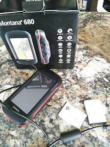
Garmin Montana 680 with EXTRA BATTERY
Estimated price for orientation: 430 $
Category: Other Camping and Hiking
Class:
Description Brand: garmin MPN: 010-01534-10 Model: montana 680 UPC: 753759143343
Rugged GPS/GLONASS with 8 Megapixel Camera and BirdsEye Subscription4-inch dual-orientation, glove-friendly touchscreen display8 megapixel autofocus camera; automatically geotags photosTracks both GPS and GLONASS satellite3-axis compass with barometric altimeterTake it hiking. Take it hunting. Take it on the water.Montana 680 features a dual-orientation, color touchscreen that’s glove friendly. The digital camera provides high-quality images, excellent resolution and automatically geotags photos with coordinates.Handheld includes 3-axis tilt-compensated compass, barometric altimeter and access to both GPS and GLONASS satellites for improved positioning and typically faster fixes.Enjoy the ViewMontana 680 has a vast 4-inch, sunlight-readable touchscreen display, giving you vivid colors and high-resolution images. Its easy-to-use touchscreen means you’ll spend more time enjoying the outdoors and less time searching for information. Take Geotagged PicturesCapture locations and memories with Montana 680’s 8 megapixel digital camera. Each photo is automatically geotagged with coordinates, allowing you to navigate back to that exact spot in the future. Insert a microSD™ card for more photo storage or to view pictures from other devices. Mount AnywhereWith an array of compatible mounts, Montana 680 is designed for use on ATVs, in boats, as a handheld or in your car or RV. Use the auto mount with City Navigator® NT maps for spoken, turn-by-turn driving directions or the rugged mount for your motorcycle or ATV. Go EverywhereAdding more maps to Montana is easy. Download TOPO U.S. 24K maps and hit the trail, plug in BlueChart® g2 preloaded cards for a day on the water or load City Navigator map data for turn-by-turn driving directions. Or, transform paper maps into files you can download to your Montana with Custom Maps. Share WirelesslyWith Montana 680, you can share your waypoints, tracks, routes and geocaches wirelessly with other compatible Garmin GPS users. Just press “send” to transfer your information to similar devices and let the games begin. Keep Your FixWith its high-sensitivity GPS and GLONASS reception, WAAS-enabled receiver and HotFix® satellite prediction, Montana 680 locates your position quickly and precisely and maintains it. Whether you’re in deep woods or just near tall buildings and trees, you can count on Montana 680. Navigate with EaseMontana 680 has a built-in 3-axis tilt-compensated electronic compass, which shows your heading even while you’re on the move or not holding it level. The barometric altimeter tracks changes in pressure to pinpoint your precise altitude, or use it to plot barometric pressure over time to help keep an eye on changing weather conditions.Double Your PowerWith a one-of-a-kind dual battery system, the 680 gives you the option of using the rechargeable lithium-ion pack or traditional AA batteries. AND I have an extra backup lithium that is included with this.
Find FunMontana 680 supports paperless geocaching GPX files for straight-to-device uploading of geocaches from Geocaching.com. No more manually entering coordinates and paper print outs, Montana stores and displays key information, including location, terrain, difficulty, hints and descriptions. The track manager feature helps organize and navigate through waypoints/routes/ and track logs (easily start/stop recording tracklogs).
Description
| Brand: | garmin | MPN: | 010-01534-10 |
| Model: | montana 680 | UPC: | 753759143343 |
Rugged GPS/GLONASS with 8 Megapixel Camera and BirdsEye Subscription4-inch dual-orientation, glove-friendly touchscreen display8 megapixel autofocus camera; automatically geotags photosTracks both GPS and GLONASS satellite3-axis compass with barometric altimeterTake it hiking. Take it hunting. Take it on the water.Montana 680 features a dual-orientation, color touchscreen that’s glove friendly. The digital camera provides high-quality images, excellent resolution and automatically geotags photos with coordinates.Handheld includes 3-axis tilt-compensated compass, barometric altimeter and access to both GPS and GLONASS satellites for improved positioning and typically faster fixes.Enjoy the ViewMontana 680 has a vast 4-inch, sunlight-readable touchscreen display, giving you vivid colors and high-resolution images. Its easy-to-use touchscreen means you’ll spend more time enjoying the outdoors and less time searching for information. Mount AnywhereWith an array of compatible mounts, Montana 680 is designed for use on ATVs, in boats, as a handheld or in your car or RV. Use the auto mount with City Navigator® NT maps for spoken, turn-by-turn driving directions or the rugged mount for your motorcycle or ATV. Share WirelesslyWith Montana 680, you can share your waypoints, tracks, routes and geocaches wirelessly with other compatible Garmin GPS users. Just press “send” to transfer your information to similar devices and let the games begin. Navigate with EaseMontana 680 has a built-in 3-axis tilt-compensated electronic compass, which shows your heading even while you’re on the move or not holding it level. The barometric altimeter tracks changes in pressure to pinpoint your precise altitude, or use it to plot barometric pressure over time to help keep an eye on changing weather conditions.Double Your PowerWith a one-of-a-kind dual battery system, the 680 gives you the option of using the rechargeable lithium-ion pack or traditional AA batteries. AND I have an extra backup lithium that is included with this.
Take Geotagged PicturesCapture locations and memories with Montana 680’s 8 megapixel digital camera. Each photo is automatically geotagged with coordinates, allowing you to navigate back to that exact spot in the future. Insert a microSD™ card for more photo storage or to view pictures from other devices.
Go EverywhereAdding more maps to Montana is easy. Download TOPO U.S. 24K maps and hit the trail, plug in BlueChart® g2 preloaded cards for a day on the water or load City Navigator map data for turn-by-turn driving directions. Or, transform paper maps into files you can download to your Montana with Custom Maps.
Keep Your FixWith its high-sensitivity GPS and GLONASS reception, WAAS-enabled receiver and HotFix® satellite prediction, Montana 680 locates your position quickly and precisely and maintains it. Whether you’re in deep woods or just near tall buildings and trees, you can count on Montana 680.
Find FunMontana 680 supports paperless geocaching GPX files for straight-to-device uploading of geocaches from Geocaching.com. No more manually entering coordinates and paper print outs, Montana stores and displays key information, including location, terrain, difficulty, hints and descriptions. The track manager feature helps organize and navigate through waypoints/routes/ and track logs (easily start/stop recording tracklogs).