Back to the main page Back to category Compasses and GPS
watch details
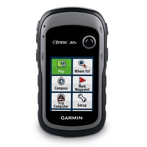
Garmin GPS eTrex 30x Handheld Navigation Device Active Map Western Europe
Estimated price for orientation: 188 $
Category: Compasses and GPS
Class:
Description Condition: New: A brand-new, unused, unopened, undamaged item in its original packaging (where packaging is applicable). Packaging should be the same as what is found in a retail store, unless the item is handmade or was packaged by the manufacturer in non-retail packaging, such as an unprinted box or plastic bag. See the seller's listing for full details. See all condition definitions- opens in a new window or tab ... Read moreabout the condition Brand: GARMIN MPN: Does Not Apply UPC: Does not apply
Handheld GPS with 3-axis compass, enhanced display and preloaded mapping eTrex 30x is the upgraded version of the popular eTrex 30, with enhanced screen resolution and extended internal memory to hold more maps. The preloaded Garmin ActiveMap supports and enhances a range of outdoor activities, such as hiking, geocaching, cycling, mountaineering and fishing. eTrex 30x has superior features compared to eTrex 30, while maintaining its ease-of-use, affordability and legendary durability. 2.2 inch crystal clear colour displayPreloaded Western Europe Garmin ActiveMap with shaded relief3,7 GB internal memory. Expand further with a microSD™ card (not included).3-axis compass and barometric altimeterWorldwide basemap with shaded reliefCompact and rugged design (IPX7)Up to 25 hours of battery life
See the way
eTrex 30x has an enhanced 2.2 inch, 65K colour, sunlight-readable display. Durable and water-resistant, eTrex 30x is built to withstand the elements. It has an upgraded interface yet retains its toughness to withstand dust, dirt, humidity or water. New tools for your trek
The new in-built 3-axis tilt-compensated electronic compass keeps your bearings even when you're standing still or not holding it level. Also added is a barometric altimeter that tracks changes in pressure to pinpoint your altitude. Use it to plot barometric pressure over time to help you keep an eye on changing weather conditions. Go anywhere
Fit your eTrex 30x just about anywhere, using an array of compatible mounts. Use the auto mount capability and City Navigator NT® maps for turn-by-turn driving directions, or the rugged mount for your bike or quad. You can even mount to a boat for fishing or sailing trips. Go global
The eTrex series can track both GPS and GLONASS satellites simultaneously - it has the ability to lock on to 24 more satellites than using just GPS. What's more, the time it takes to "lock on" to a position is (on average) 20% faster than using GPS alone. With its high-sensitivity EGNOS-enabled GPS receiver and HotFix satellite prediction, eTrex locates your position quickly and precisely and maintains its GPS location even in heavy cover and deep valleys. Preloaded Garmin ActiveMap
eTrex 30x comes preloaded with the Garmin ActiveMap of Western Europe, a perfect starting point for your first recreational activity with GPS. The map provides relevant useful information for activities like hiking and cycling, it's routable and shows elevation changes*. Garmin ActiveMap Western Europe covers the following countries: Albania, Andorra, Austria, Belgium, Denmark, Finland, France, Germany, Iceland, Ireland, Italy, Liechtenstein, Luxembourg, Malta, Monaco, Netherlands, Norway, Portugal, San Marino, Spain, Sweden, Switzerland, United Kingdom and the Vatican City. Use the microSD™ card slot to load additional advanced maps - like Topo maps, BlueChart® g2 marine maps or City Navigator® NT maps. eTrex 30x also supports Satellite Imagery (subscription required) to download and integrate with your maps. Share wirelessly
eTrex 30x lets you share your routes, geocaches and other user data wirelessly with other compatible devices. Simply press "send" to transfer your information and share your adventure with friends. eTrex also connects to compatible Garmin devices, including VIRB™ action camera and accessory sensors, including tempe™, foot pod and heart rate monitor. Keep Your Fix
With its high-sensitivity, EGNOS-enabled GPS receiver and HotFix satellite prediction, eTrex locates your position quickly and precisely and maintains its GPS location even in heavy cover and deep valleys. Find Fun
eTrex 30x supports paperless GPX files for endless geocaching adventures. Just visit Take control of your next adventure with . The free, trip-planning software allows you to view and organise maps, routes and more, and even create to share with friends, family or fellow explorers. BaseCamp displays topographic map data in 2D or 3D on your computer screen, as well as a vast array of satellite images when paired with a Satellite Imagery subscription. Dimensions and performance:
Unit dimensions, WxHxD: 5.4 x 10.3 x 3.3 cmDisplay size, WxH: 3.5 x 4.4 cm; 2.2" diag (5.6 cm)Display resolution, WxH: 240 x 320 pixelsDisplay type: 2.2" transflective, 65K colour TFT2 AA batteries (not included); NiMH or Lithium recommendedUp to 25 hours battery lifeWaterproof (IPX7)High-sensitivity receiverInterface: USBBarometric altimeterElectronic compassUnit-to-unit transfer: shares data wirelessly with similar units
Outdoor Features:
Automatic routing, turn by turn routing on roads (with optional mapping for detailed roads)Geocaching-friendly (paperless)Custom maps compatiblesun and moon informationTide tables (with optional Bluechart)Area calculationPicture viewer
Maps and memory:
BasemapPreloaded maps: Garmin ActiveMap of Western EuropeAbility to add mapsBuilt-in memory: 3.7 GBAccepts microSD™ cardsRecord up to 2000 waypoints and 200 routesTrack log: 10,000 points, 200 saved tracks
Description
| Condition: | New: A brand-new, unused, unopened, undamaged item in its original packaging (where packaging is applicable). Packaging should be the same as what is found in a retail store, unless the item is handmade or was packaged by the manufacturer in non-retail packaging, such as an unprinted box or plastic bag. See the seller's listing for full details. See all condition definitions- opens in a new window or tab ... Read moreabout the condition | Brand: | GARMIN |
| MPN: | Does Not Apply | UPC: | Does not apply |
Handheld GPS with 3-axis compass, enhanced display and preloaded mapping eTrex 30x is the upgraded version of the popular eTrex 30, with enhanced screen resolution and extended internal memory to hold more maps. The preloaded Garmin ActiveMap supports and enhances a range of outdoor activities, such as hiking, geocaching, cycling, mountaineering and fishing. eTrex 30x has superior features compared to eTrex 30, while maintaining its ease-of-use, affordability and legendary durability. 2.2 inch crystal clear colour displayPreloaded Western Europe Garmin ActiveMap with shaded relief3,7 GB internal memory. Expand further with a microSD™ card (not included).3-axis compass and barometric altimeterWorldwide basemap with shaded reliefCompact and rugged design (IPX7)Up to 25 hours of battery life
See the way
eTrex 30x has an enhanced 2.2 inch, 65K colour, sunlight-readable display. Durable and water-resistant, eTrex 30x is built to withstand the elements. It has an upgraded interface yet retains its toughness to withstand dust, dirt, humidity or water. New tools for your trek
The new in-built 3-axis tilt-compensated electronic compass keeps your bearings even when you're standing still or not holding it level. Also added is a barometric altimeter that tracks changes in pressure to pinpoint your altitude. Use it to plot barometric pressure over time to help you keep an eye on changing weather conditions. Go anywhere
Fit your eTrex 30x just about anywhere, using an array of compatible mounts. Use the auto mount capability and City Navigator NT® maps for turn-by-turn driving directions, or the rugged mount for your bike or quad. You can even mount to a boat for fishing or sailing trips. Go global
The eTrex series can track both GPS and GLONASS satellites simultaneously - it has the ability to lock on to 24 more satellites than using just GPS. What's more, the time it takes to "lock on" to a position is (on average) 20% faster than using GPS alone. With its high-sensitivity EGNOS-enabled GPS receiver and HotFix satellite prediction, eTrex locates your position quickly and precisely and maintains its GPS location even in heavy cover and deep valleys. Preloaded Garmin ActiveMap
eTrex 30x comes preloaded with the Garmin ActiveMap of Western Europe, a perfect starting point for your first recreational activity with GPS. The map provides relevant useful information for activities like hiking and cycling, it's routable and shows elevation changes*. Garmin ActiveMap Western Europe covers the following countries: Albania, Andorra, Austria, Belgium, Denmark, Finland, France, Germany, Iceland, Ireland, Italy, Liechtenstein, Luxembourg, Malta, Monaco, Netherlands, Norway, Portugal, San Marino, Spain, Sweden, Switzerland, United Kingdom and the Vatican City. Use the microSD™ card slot to load additional advanced maps - like Topo maps, BlueChart® g2 marine maps or City Navigator® NT maps. eTrex 30x also supports Satellite Imagery (subscription required) to download and integrate with your maps. Share wirelessly
eTrex 30x lets you share your routes, geocaches and other user data wirelessly with other compatible devices. Simply press "send" to transfer your information and share your adventure with friends. eTrex also connects to compatible Garmin devices, including VIRB™ action camera and accessory sensors, including tempe™, foot pod and heart rate monitor. Keep Your Fix
With its high-sensitivity, EGNOS-enabled GPS receiver and HotFix satellite prediction, eTrex locates your position quickly and precisely and maintains its GPS location even in heavy cover and deep valleys. Find Fun
eTrex 30x supports paperless GPX files for endless geocaching adventures. Just visit Take control of your next adventure with . The free, trip-planning software allows you to view and organise maps, routes and more, and even create to share with friends, family or fellow explorers. BaseCamp displays topographic map data in 2D or 3D on your computer screen, as well as a vast array of satellite images when paired with a Satellite Imagery subscription. Dimensions and performance:
Unit dimensions, WxHxD: 5.4 x 10.3 x 3.3 cmDisplay size, WxH: 3.5 x 4.4 cm; 2.2" diag (5.6 cm)Display resolution, WxH: 240 x 320 pixelsDisplay type: 2.2" transflective, 65K colour TFT2 AA batteries (not included); NiMH or Lithium recommendedUp to 25 hours battery lifeWaterproof (IPX7)High-sensitivity receiverInterface: USBBarometric altimeterElectronic compassUnit-to-unit transfer: shares data wirelessly with similar units
Outdoor Features:
Automatic routing, turn by turn routing on roads (with optional mapping for detailed roads)Geocaching-friendly (paperless)Custom maps compatiblesun and moon informationTide tables (with optional Bluechart)Area calculationPicture viewer
Maps and memory:
BasemapPreloaded maps: Garmin ActiveMap of Western EuropeAbility to add mapsBuilt-in memory: 3.7 GBAccepts microSD™ cardsRecord up to 2000 waypoints and 200 routesTrack log: 10,000 points, 200 saved tracks